
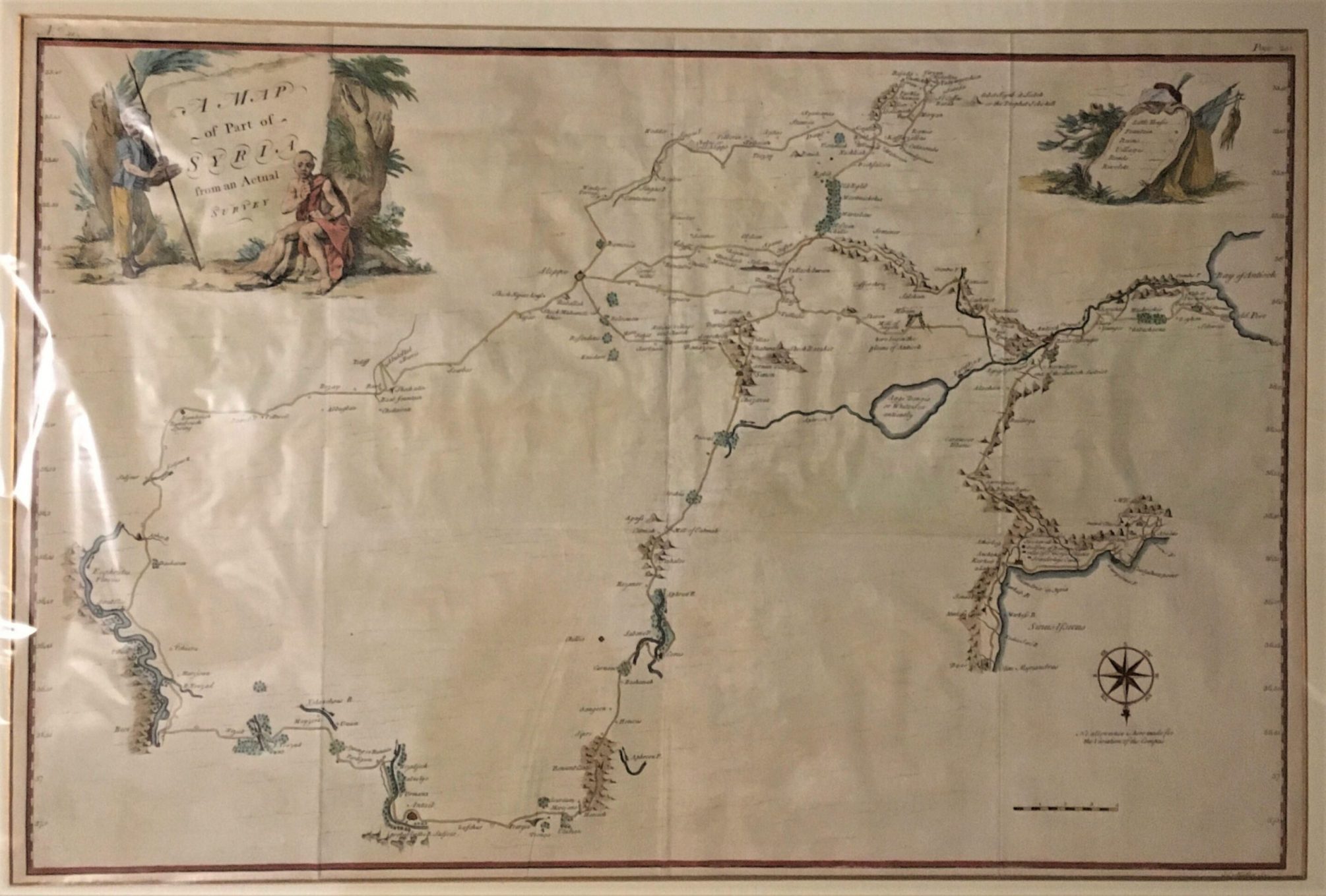
A Map of Part of Syria from an Actual Survey.
Muller, Johann Sebastian.
Synopsis
An extremely uncommon 1754 map of Syria by Alexander Drummond. Most likely the earliest scientifically surveyed map of the interior of northern Syria. Oriented to the south, the map is roughly centered on Aleppo, where Drummond was stationed as British Consul. It extends over the areas the Drummond traveled and personally surveyed: westward to the Bay of Antioch (near modern day Hatay, Turkey) and east as far as the Euphrates River, an again north to the Sinus Issicus (modern day Gulf of Iskenderun). Inland the map extends further north to a city identified as Antaib, also known as Antiochia Penes Tarum, an ancient Roman city most likely corresponding to modern day Gaziantep or Antep, on the Turkey-Syria border.
Drummond’s map is remarkable in that he copies nothing from earlier works, taking great pains to map only those sites he has actually personally experienced and surveyed. Though some of his distances are skewed, Drummond’s map represents a significant cartographic leap forward in the modern mapping of Syria. Despite the fact that Drummond’s focus is the ruins of antiquity, his place names and location references are particularly thorough and important. This includes some of the earliest references to various Syrian villages, fortresses, churches, mills, roadways, and terrain. Drummond had a personal interest in Syrian Christianity and the detail with which he notes various churches throughout is of exceptional interest.
The curious cartouche, in the upper left quadrant depicts a turbaned spear wielding slaver, possibly an Ottoman, and to his right, a depressed looking, scantily clad, chained slave. Drummond was a harsh critic of Ottoman rule and the message of the cartouche is clear, the slaver is the Ottoman Empire and the slave the oppressed people of Syria. Though the Ottoman Empire no longer controls Syria, parallels might be made to the region’s current state of unrest.
The map was engraved by Johann Sebastian Muller, also known as John Sebastian Miller, a German born by London based engraver. Muller was not specifically a map engraver or a cartographer, so we can surmise that much of the depth of this map stems from the fact that he made no effort to reconcile and embellish Drummond’s manuscript map with known cartographic knowledge – as would have been the norm had Drummond passed the work on to an established English map engraver of the period such as Thomas Jefferys or Robert Sayer.


