
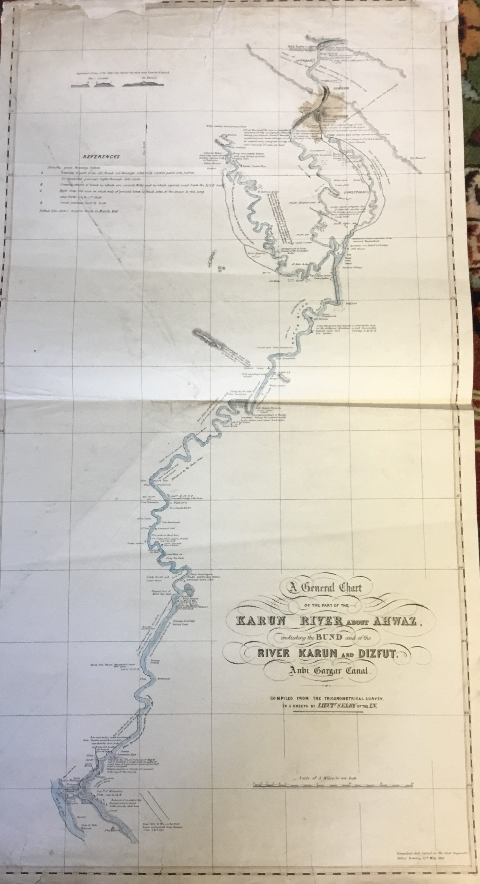
A general chart of the part of the Karun River about Ahwaz including the bund and the River Karun and Dizfut aubi Gargar Canal.
Selby. Lieutenant W. B.
Synopsis
“ With the intensification of the Anglo-Russian rivalry in the late 1800s over Iran’s geopolitical position and commercial resources, Great Britain began to exert immense pressure on the Shah’s government to provide it with access to the Karun trade route. This meant the opening of the only navigable river in Iran to British vessels, as well as the construction of a carriage road and/or a railway line in order to link the interior to the open seas.
Direct British trade with Basra dates back to 1635, and the earliest record in the British archives regarding the affairs of Khuzestan (Ḵuzestān) is a dispatch dated 9 April 1767 referring to the Kaʿb tribe (Saldana, p. 2). The increasing commercial and political importance to Britain of the Persian Gulf and its littoral indicated the insufficient amount of information at her disposal. Hence the British attempts to carry out geographical surveys in southwest Persia and Mesopotamia in the first half of the 19th century. Henry Blosse Lynch, John Campbell (q.v.), Felix Jones, Henry Rawlinson, and Austen Henry Layard (q.v., online) were among those who between the late 1830s and early 1850s were actively involved in these surveys. Lieutenant Selby also studied the Karun with its branches and effluents. One of the principal aims of these missions seems to have been to open the southern provinces of Iran to British influence and trade”. (British Encyclopaedia).


