
Asia Nova Descriptio.
Ortelius, Abraham.
Synopsis
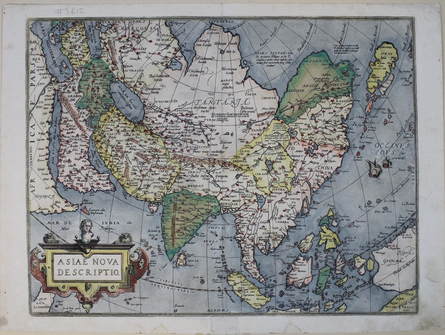
Abraham Ortelius (1527-1598) was one of the most remarkable masters of the Dutch cartographic school, and he took transformation in the maps of the Arabian Peninsula begun by Gastaldi further. He used data that arrived at the cartography centre in Antwerp and took advantages of the technical progress in European cartography whereas he himself did not make a personal contribution to this progress.
This is a new plate of the 1570 map, copied word for word. In the Arabian Peninsula the name Ara, a city at the mouth of the Red Sea, has been omitted, while Medina Tallnabi becomes Medina, the word Tallnabi being moved to the left to cover a formerly nameless town south of Iabut. “The standard map of Asia for more than forty years” (Sweet).
From: Theatrum Orbis Terrarum, Apud Christophorum Plantinum: Antverpiae, 1579. fol. BM. Maps. C.2. c.13.
References: Tibbetts, Arabia. Nr. 41; Sweet Asia Nr.5; Farbabb 19.


