
Palestine ancienne et moderne d’après les sources les plus authentiques.
Andriveau-Goujon J.
Synopsis
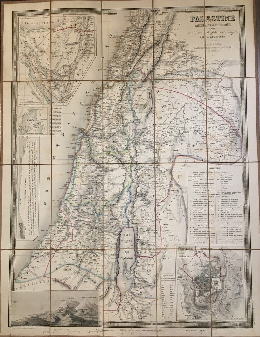
An extremely attractive and impressive map of Palestine, or the Holy Land by French cartographer Andriveau-Gujon. Covers Palestine and regions of Lebanon, Syria, Jordan, and the Sinai in considerable detail. Identifies both archaic and modern place names and offers a wealth of both political and geographical information. In the lower left hand quadrant there is a detailed inset of Jerusalem. The lower left quadrant hosts a comparative elevation chart or mountains chart. Looking to the upper left quadrant we find several insets including a map of the Sinai, a detail of the Gulf of Suez, including depth soundings and ferryboat crossings and a land profile chart of the Mediterranean basin. Published by the French cartographer E. Andriveau-Goujon on Rue de Bac, 21, Paris, as plate 18 in the 1870 edition of Andriveau-Goujon’s Atlas Universel.
J. Andriveau and J. Goujon (fl. 1805-94), working collectively as Andriveau-Goujon, were among the most prominent cartographic publishers in 19th century France. Maps by Andriveau-Goujon are often confusing to identify as they can be alternately singed J. Goujon, J. Andriveau, J.Andriveau-Goujon or simply Andriveau-Goujon. They published numerous pocket maps and atlases throughout the 19th century and often worked with other prominent French cartographers of the time such as Brue and Levasseur. Andriveau-Goujon are especially well known for their high quality case and library maps.


