
- Books
- ARCHAEOLOGY
- ART & ARCHITECTURE
- ALGERIA
- AMERICAN ART
- ARAB ART
- ARABIC CALLIGRAPHY
- ARABIC MUSIC
- ARABIC PRINTING
- ARMENIA
- ARMENIAN ART
- ASIA
- ASIAN ART
- BIBLIOGRAPHY
- BOOK BINDING
- BOOKBINDING
- CALLIGRAPHY
- CARPETS
- CERAMICS
- CHRISTIANITY
- EGYPT
- EUROPE
- EUROPEAN ART
- FRANCE
- GREECE
- HOLY LAND
- INDIAN ARCHITECTURE
- INDIAN ART
- IRAN
- IRAQ
- ISLAMIC ARCHITECTURE
- ISLAMIC ART
- ISLAMIC COSTUMES
- ISLAMIC JEWELLERY
- ISLAMIC SPAIN
- ISLAMIC TEXTILES
- JEWELLERY
- JORDAN
- LEBANON
- LITHOGRAPHY
- MINIATURE
- MODERN ART
- MOROCCO
- MUSIC
- NETHERLANDS
- NORTH AFRICA
- ORIENTALISM
- PALESTINE
- PERSIAN ART
- PERSIAN MINIATURE
- RUSSIA
- SYRIA
- TEXTILE
- TEXTILES
- THEATRE
- TURKEY
- TURKISH ARCHITECTURE
- TURKISH ART
- YEMEN
- BIBLIOGRAPHY
- AFRICAN ART
- AMERICANA
- ARAB GULF
- ARABIA
- ARABIAN PENINSULA
- ARABIC PRINTING
- ARMENIA
- ASIA
- BIOGRAPHY
- CENTRAL ASIA
- CHINA
- CHRISTIANITY
- EGYPT
- GEOGRAPHY
- IRAN
- ISLAM
- ISLAMIC LITERATURE
- ISLAMIC SCIENCE
- ISLAMIC SPAIN
- JORDAN
- JUDAISM
- LEBANON
- LITERATURE
- MIDDLE EAST
- MODERN ART
- MOROCCO
- NEAR EAST
- NORTH AFRICA
- OMAN
- PALESTINE
- SAUDI ARABIA
- SAUDIA ARABIA
- SPAIN
- STAMPS
- SYRIA
- YEMEN
- BIOGRAPHY
- ALGERIA
- ARABIA
- ARABIC LITERATURE
- ASIA
- CHRISTIANITY
- EGYPT
- HISTORY
- IRAN
- IRAQ
- ISLAM
- ISLAMIC HISTORY
- ISLAMIC PHILOSOPHY
- ISLAMIC THOUGHT
- JORDAN
- KUWAIT
- LEBANON
- LEBANON & SYRIA
- LIBYA
- MIDDLE EAST
- NORTH AFRICA
- OTTOMAN HISTORY
- PALESTINE
- POETRY
- POLITICS
- SAUDI ARABIA
- SUDAN
- SYRIA
- SYRIA & LEBANON
- T E LAWRENCE
- T. E. LAWRENCE
- TRAVEL
- TURKEY
- YEMEN
- ECONOMY
- GEOGRAPHY
- AFRICA
- ALGERIA
- ARAB GULF
- ARABIA
- ARABIAN PENINSULA
- ASIA
- ASTRONOMY
- CARTOGRAPHY
- EGYPT
- EUROPE
- GEMEALOGY
- HISTORY
- IRAN
- IRAQ
- ISLAM
- ISLAMIC ART
- ISLAMIC PILGRIMAGE
- ISLAMIC SCIENCE
- ISLAMIC SPAIN
- JORDAN
- KUWAIT
- LEBANON
- MIDDLE EAST
- NORTH AFRICA
- OIL INDUSTRY
- ORIENTALISM
- PALESTINE
- PERSIAN EMPIRE
- PETROL
- RED SEA
- SAUDI ARABIA
- SUDAN
- SYRIA
- SYRIA & LEBANON
- TRAVEL
- TUNIS
- TURKEY
- YEMEN
- HISTORY
- AFRICAN HISTORY
- ALGERIA
- ARAB
- ARAB GULF
- ARAB HISTORY
- ARABIA
- ARABIAN PENINSULA
- ARABIC PRINTING
- ARABS
- ARMENIA
- ASIA
- ASIA MINOR
- ASIAN HISTORY
- AVIATION
- BAHRAIN
- BALKAN WAR
- BIOGRAPHY
- CENTRAL AMERICA
- CENTRAL ASIA
- CHRISTIANITY
- CRUSADE WARS
- CRUSADES
- CRUSADES WARS
- EASTERN CHURCH
- EASTERN QUESTIONS
- EGYPT
- EGYPTIAN HISTORY
- EUROPE
- EUROPEAN HISTORY
- FRANCE
- FRENCH HISTORY
- GERMANY
- GREECE
- INDIA
- IRAN
- IRAN-IRAQ
- IRAQ
- IRAQ ARAB GULF
- iSLAM
- ISLAMIC ARCHITECTURE
- ISLAMIC HISTORY
- ISLAMIC PILGRIMAGE
- ISLAMIC SCIENCE
- ISLAMIC SPAIN
- ITALY
- JORDAN
- JUDAICA
- KURDS
- KUWAIT
- LAW
- LEBANON
- LYBIA
- MIDDLE EAST
- MILITARY
- MONGOL EMPIRE
- MOROCCO
- NEAR EAST
- NIGERIA
- NORTH AFRICA
- NORTH HISTORY
- OMAN
- OTTOMAN EMPIRE
- OTTOMAN HISTORY
- OTTOMAN PERIOD
- OTTOMAN- RUSSIAN WAR
- PALESTINE
- PERSIA
- PERSIAN HISTORY
- PERSIAN LITERATURE
- RED SEA
- RELIGION
- RUSSIA
- SAUDI ARABIA
- SCIENCE
- SUDAN
- SYRIA
- SYRIA & LEBANON
- SYRIAN HISTORY
- TRAVEL
- TURKEY
- YEMEN
- LINGUISTICS
- LITERATURE
- AFRICAN LITERATURE
- ARABIC LITERATURE
- ARABIC POETRY
- ART & ARCHITECTURE
- ASIA
- ASIAN LITERATURE
- BERBER LITERATURE
- CHINA
- EGYPT
- ENGLAND
- ENGLISH
- EROTISM
- EUROPE
- EUROPEAN
- EUROPEAN LITERATURE
- FOLK TALES
- FRENCH
- GERMAN
- GERMAN LITERATURE
- GERMANY
- GREECE
- GREEK LITERATURE
- HISTORY
- INDIA
- INDIAN PHILOSOPHY
- ISLAM
- ISLAMIC PHILOSOPHY
- ISLAMIC SPAIN
- LINGUISTICS
- MIDDLE EAST
- MUSIC
- ORIENTALISM
- PALESTINE
- PERSIAN
- PERSIAN LITERATURE
- POETRY
- SPANISH
- SWEDEN
- TURKEY
- MANUSCRIPTS
- MAPS
- NATURAL HISTORY
- PAINTING
- PERIODICAL
- PHOTOGRAPHY
- POLITICS
- ALGERIA
- ARAB GULF
- ARABIA
- ARABIAN GULF
- ARABIAN PENINSULA
- ARGENTINA
- ASIA
- BAHRAIN
- BALKAN
- Canada
- CENTRAL ASIA
- ECONOMY
- EGYPT
- ENGLAND
- EUROPE
- GERMANY
- GULF
- HISTORY
- INDIAN OCEAN
- IRAN
- IRAQ
- ISLAMIC HISTORY
- JORDAN
- KUWAIT
- LATIN AMERICA
- LEBANON
- LIBYA
- MALAYSIA
- MIDDLE EAST
- NEAR EAST
- NORTH AFRICA
- OMAN
- PALESTINE
- PERSIAN GULF
- RELIGION
- RUSSIA
- SAUDI ARABIA
- SOUTHERN ASIA
- SUDAN
- SYRIA
- SYRIA & LEBANON
- TUNISIA
- TURKEY
- UNITED ARAB EMIRATES
- YEMEN
- POSTER
- RELIGION
- ASIA
- BIOGRAPHY
- CHRISTIANITY
- CHURCH HISTORY
- CRUSADE WARS
- CRUSADES
- DRUSE
- DRUZE
- EGYPT
- HINDUISM
- HISTORY
- INDIA
- IRAN
- ISLAM
- ISLAMIC HISTORY
- ISLAMIC LAW
- ISLAMIC PHILOSOPHY
- ISLAMIC PILGRIMAGE
- ISLAMIC SOCIETY
- ISLAMIC SPAIN
- ISLAMIC TAX LAW
- ISLAMIC TEXTS
- ISLAMIC THEOLOGY
- JUDAICA
- JUDAISM
- LEBANON
- MIDDLE EAST
- OMAN
- PHILOSOPHY
- PROPHET MUHAMMAD
- RARE ISLAM
- SAUDI ARABIA
- SCIENCE
- SCIENCES
- SOCIAL STUDIES
- AFRICA
- ARAB GULF
- ARAB WOMEN
- ARABIA
- BAHRAIN
- BEDOUINS
- COOKERY
- CULINARY
- EGYPT
- EGYPT MEDICINE
- EUROPE
- FREEMASONARY
- INDIA
- ISLAM
- ISLAMIC LAW
- ISLAMIC SOCIETY
- JORDAN
- JUDAICA
- LAW
- LEBANON
- MIDDLE EAST
- NEAR EAST
- NORTH AFRICA
- ORIENTALISM
- PALESTINE
- PERSIAN GULF
- SAUDI ARABIA
- SPORTS
- SUDAN
- SYRIA
- TURKEY
- UNITED ARAB EMIRATES
- T. E. LAWRENCE
- TRAVEL
- AFRICA
- ARABIA
- ARABIAN PENINSULA
- ARMENIA
- ASIA
- CENTRAL AMERICA
- CENTRAL ASIA
- CHINA
- EGYPT
- EGYPTE
- EUROPE
- GREECE
- HISTORY
- HOLY LAND
- HOLYLAND
- IRAN
- IRAQ
- ISLAM
- ISLAMIC EMPIRE
- ISLAMIC PILGRIMAGE
- ISLAMIC SPAIN
- JORDAN
- LEBANON
- LEVANT
- MEXICO
- MIDDLE EAST
- NATURAL HISTORY
- NEAR EAST
- NORTH AFRICA
- NORTH POLE
- OIL INDUSTRY
- OMAN
- OTTOMAN EMPIRE
- PALESTINE
- PERSIA
- PERSIAN ART
- PILGRIMAGE
- RED SEA
- RUSSIA
- SAUDI ARABIA
- SUDAN
- SWITZERLAND
- SYRIA
- SYRIA & LEBANON
- TURKEY
- YEMEN
- TRAVEL & HISTORY
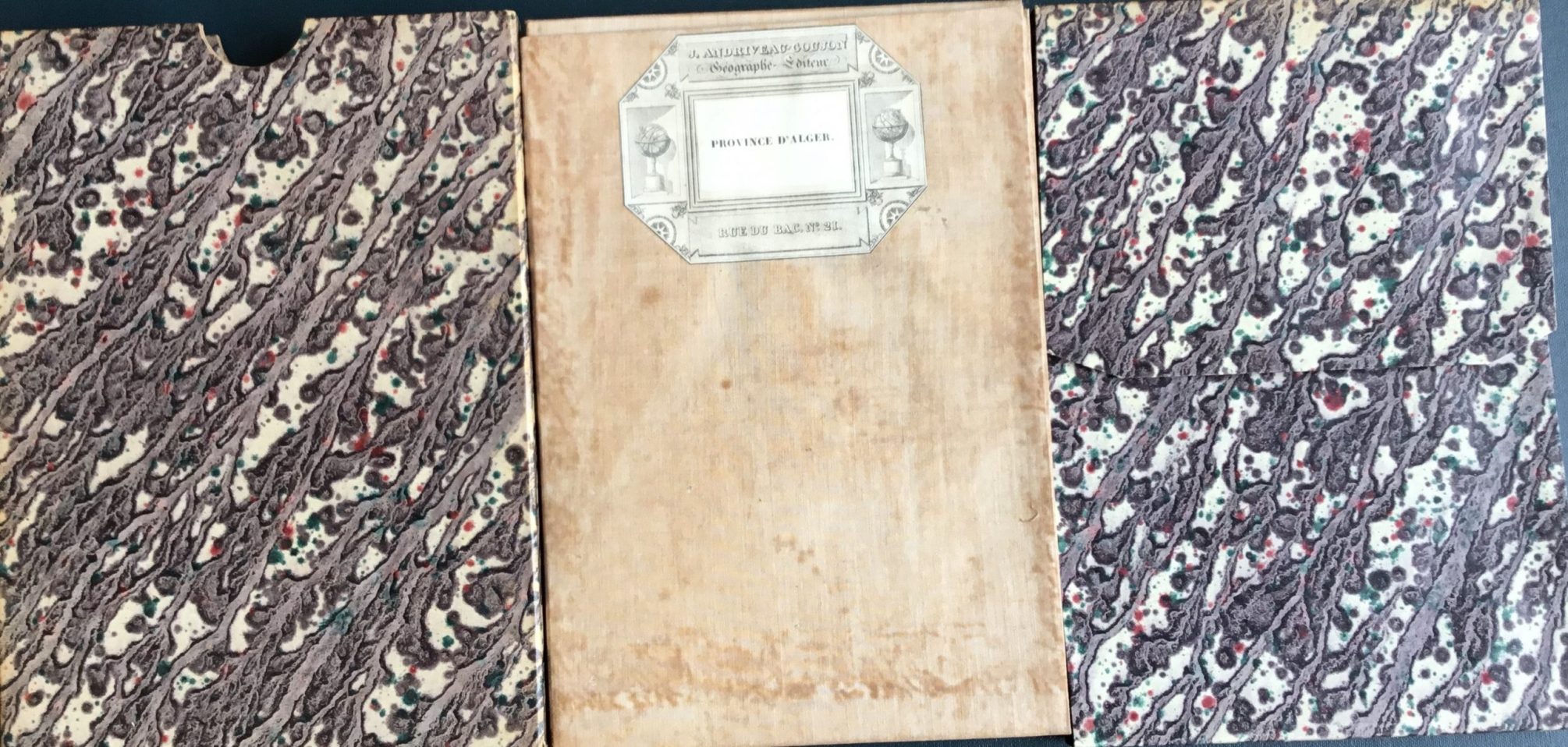
Province d’Alger.
Vuillemin, Alexandre A. 1812-1880.


Synopsis
Alexandre Vuillemin was a prominent 19th century French cartographer and editor based in Paris. He produced a number of atlases, and his maps are noted for the frequent use of extensive margin illustrations – vignettes, famous people, and views of cities. His atlases were popular, and many went through multiple editions.
Produced by Vuillemin, this finely crafted steel engravings capture the land and character of the area, as only the French could. While the quality of cartography is exemplar for the time, showing us all the detail of towns, villages as well as rivers and streams, one is immediately struck by how decorative these maps are. Here we see a dramatic glimpse of part of Algeria, the exotic colony on Africa’s northern coast. These maps give us remarkable details for this ancient land which spans from the Mediterranean across the Atlas mountains, and ends at the edge of the Sahara desert.


